Showing posts with label the Rockies. Show all posts

Thursday, November 06, 2025

A Jaunt Into the Rockies


Early this week we left our island home, crossed the Strait on a ferry, and enjoyed dinner with my parents and siblings. Monday morning saw us slip quietly out of the house in the early morning darkness, and drive up over the Coastal Mountains (snow!), down into the interior plateau, winding along a river and through another mountain pass to arrive at Jasper, Alberta. The almost full moon welcomed us on our first night, glowing through the clouds. 


Jasper National Park lies next to its larger and probably more famous neighbour, Banff National Park. It had its beginnings as a fur trading post, then a railway town. The trains come and go here throughout the day, but quietly, with no whistles. In July 2024 wildfires swept the surrounding mountains, burning up to the tree line. To add to the devastation, 30 percent of the townsite burned - private homes, small business, hotels, and historic churches. There is a huge building program going on now to replace these structures. Everyone we spoke with was very positive about the future.


The smell of the burned forest still wafts through the area. Denuded trees stand as tall sentinels to the fierce winds and flames that ravaged hectares and hectares of land. 


The temperature on our first day exploring was COLD for us. -10 degrees Celsius. I layered up as much as I could, and then wore Tim's down vest over my down jacket. There was no snow in town, but when we drove to Maligne Lake, snow crunched underfoot and ice is forming on the edge of the lake. 


Such amazing scenery. We were in awe at every turn, surrounded by high peaks whose crags and ridges were highlighted by snow. 


Curves of water and rocks lead the eye to the tall peaks. Clear blue sky all day made everything crisp and bright. 


Jasper is about 360 kilometres further north than our home (and 878 km to drive). By 3 pm shadows slant long across the ground and the sun slips behind the mountains much earlier than we're used to. Above you can see the golden grasses - the first plants to grow under the burned forest. It's truly amazing how nature is rejuvenating. Beauty from ashes. 


That first day we also visited Athabasca Falls. Water levels are low at this time of year, but there was still plenty of thundering and crashing. Icicles are formed by the spray from the falls. 


And soon the sun slides beneath the hills as the water calms into the wide river. 


That gorgeous glacier green/blue water reflects everything beautifully. The fires burned right to the water. 

Tomorrow we drive home. It will take about 8.5 hours to the ferry, then 90 minutes to cross and 30 minutes from there. We've had such a wonderful time and there are more stories to tell. I'm looking forward to catching up with all of you once I'm settled again. 

Tuesday, September 21, 2021

Kicking Horse River, Moraine Lake, Eiffel Lake


I have wanted to try river rafting for a long time, and I finally got onto the river on our recent vacation. Some of Tim's siblings joined us. We rafted on the Kicking Horse River, which feeds into the Columbia. 

There was a lot of orientation before going out, and we put on wetsuits and jackets, along with helmets, wet boots, and life jackets. Our guide was very professional and a lot of fun, giving us tidbits of information when we were in the calmer parts of the river.


The water is low at this time of year, so we dodged a lot of rocks. Into the water went our paddles at our guide's instructions, and then out again as we "held on" to shoot through the rapids. Tim was in front in the raft, and I was several places behind, on the other side. We all got very wet, but it wasn't uncomfortable at all because of the wetsuits. Without them the glacier fed water would be oh, so very cold. It was a LOT of fun and I'd do it again in a heartbeat. 


Moraine Lake is one of the "Jewels of the Rockies." It's near Lake Louise and was been featured on the Canadian $20 bill from 1969 to 1979. It lies at the base of the Valley of the Ten Peaks, so named for the surrounding mountains. 

Because it's so iconic, it's very popular with tourists and hikers alike. When we went to the park office for some trail maps, the agent told us that the parking lot here fills up between 5 and 6 AM. Yikes! There is a shuttle, but because we would be hiking, we wanted to have our vehicle there. So we prepared a packable breakfast of fruit, granola, and yogurt, made some tea, and left our camping trailer around 5:15. Temperatures had fallen to freezing overnight and it was cold and very dark when we arrived at the parking lot at 5:30 - to pull into one of the last half-dozen of 150 parking spots. Lucky us! 

It was a clear night/morning, and the stars over the great peaks filled the sky with light and magic. 


We began our hike just as the mountain peaks were lighted by pale clouds reflecting the rising sun, around 6:35. It was still dark in the forest, but Tim's headlamp lighted the way and as the sun rose, light grew.

The ten peaks around Lake Moraine were named by Samuel E. S. Allen using the indigenous words for numbers one through ten. Most have been renamed. 


Frost on the wild strawberries. Brrr. We were glad we brought wool sweaters and gloves. 


How lovely it was to see the mountain peaks kissed by the sun, and the sharp shadows created by other massive mountains.

Moraine Lake lies at about 6100 feet above sea level. In the first hour on the trail we climbed another 1000 feet, going back and forth across the mountain slope in a series of switchbacks. It was hard work. Once we reached 7100 feet, we climbed another 400 feet over a much more gradual incline. 


Here we are, still smiling!


Our goal was Eiffel Lake, seen above. The trail doesn't lead to the lake itself, but carries on for another 4 kilometres to Sentinel Pass. We turned back not long after this point.


On our way up we saw no one else on this particular trail. Just the two of us in this vast landscape, surrounded on all sides by enormous mountains. In the photo above you can see the glacier, mostly covered with gravel at this time of year, and just above Tim is Wenkchemna Peak, the last of the ten peaks surrounding this valley. 


How small and insignificant we felt. How clear and crisp the air was. Tim is seen above, walking on the scree, and I am the little shadow below, a bit further back. 

The verse, "O Lord, how majestic is your name in all the earth" came to mind as we viewed these scenes.


At a trail junction on the way back, we took a little hike towards Larch Valley, where the larch trees are just beginning to turn golden. Another beautiful glacier view. We didn't go more than a couple of kilometres along this trail as we were both getting tired and there was still that steep descent ahead of us. 

Once we returned to the truck, we had a snack (lunch was eaten early on the trail), took off our hiking boots, wiggled our toes in joy, and rested a bit before exploring the area around the lake a bit. 

It was such a great day. Although I'm not fond of early rising, it was such a wonderful sight to see the mountains being revealed as the sun rose. I think I would do it again! 

Sunday, September 19, 2021

Snippets from the Mountains


On the first Sunday of September, we locked the door and drove to the ferry, towing our travel trailer behind us. Once across the Strait, we drove to my parents' home in Abbotsford and enjoyed lunch and a short visit with them before driving over the Coastal Mountains, across the Interior plain, and into the Columbia Mountains. 

The town of Revelstoke was a good place to spend two nights. We walked along the river in the evening, admiring the vast Columbia River that begins in BC and loops its way through the mountains before crossing the border into Washington State. A stone arch commemorating workers seemed fitting on Labour Day weekend. Mount Begbie is seen in the distance. 


Once, when I was very young, my parents took my sister and me to The Enchanted Forest. For nostalgia's sake, Tim and I revisited the place on our trip. He had never been there. It's a place full of whimsy and fairy tales. My one distinct memory was of a large egg with a window in it through which one could peer in to see a medieval village. The egg was still there, and it was still enchanting. 
Above is the straw home of the first little pig. The buildings are small scale, child-sized, but I saw a number of adults crouching in to walk through them. It was a fun trip down memory lane.


Not too far across the highway was Three Valley Gap, where an enterprising gentleman who wanted to save the history of the area bought a large piece of property, and over many years he moved historical buildings onto it, creating an old town. Above is St. Stephen's Church, built in 1887 in the town of Donald, moved to the town of Field in 1902, and finally to Three Valley Gap in 1967. 

The buildings, including school houses and a three-story hotel, were dismantled board by board and reconstructed. 

One of the rules for teachers from 1872 that hung in one of the old schoolhouses stated that "Male teachers may take one evening each week for courting purposes, or two evenings a week if they attend church regularly." Another rule stated "Teachers each day will fill the lamps, trim the wicks, and clean chimneys." 


From Revelstoke we traveled into the Rocky Mountains (there are range after range of mountains, but they are collectively known as the Rockies). The town of Golden was our stopping place for several nights. Here we met up with two of Tim's siblings and their spouses and enjoyed good food and good times around the fire, along with some fun activities. 

Tim and I visited the Golden Skybridge, a new attraction featuring Canada's highest suspension bridge. Two suspension bridges cross a very deep canyon. 

When we lived in the jungle in Ecuador, a suspension bridge over a river connected the hospital where Tim worked with the property where we lived. We all got very used to walking across it, although it took me a little bit of time to do so. Although the Golden Skybridge is much longer and much higher, I felt that I could walk across it without too much difficulty. 

I did have Tim walk in front of me so that I could focus on his back rather than a vast amount of space ahead of me. Looking down didn't bother me, but looking out across the expanse did. 


On the far side of the canyon a wooden beam is suspended for the sole purpose of taking photos. However, the bench is not stable and requires some balancing to actually let go and "touch the sky". 

I thought I could get away with hanging on with one hand and was just about to get down after another tourist took the photo, when someone else said, "she didn't let go!" And here I thought I could get away with cropping the photo to make it look like I had. So, another photo was taken and I let go for a very short second. The bench was very wobbly! 


With Tim's brother and sister we visited Wapta Falls on the Kicking Horse River. The hike was mostly level until the very end. This is the view from the top of the falls, thundering and crashing tons of water. 


We hiked down into the river bed, and could walk out to face the falls as the water level was low. The rocks were such pretty colours and shapes, smoothed by the water. 


The falling water created huge sprays of mist that dampened our hair and clothing. It was exhilarating to stand there and experience the power of the falls up close. We climbed onto the small hill in front of the falls to watch the water tumble down. 


During the spring and early summer the area we walked on is covered by water. These stone structures were built by others who walked here, and some winter/spring, they will be washed into the river. 

I hope you've enjoyed this little taste of the mountains of British Columbia. There are more experiences to share. I am always amazed at the beauty and magnificence of our province. I was surprised at how many tourists were in the area - from Europe and the UK, and Asia. Our air border opened to vaccinated visitors on September 7, and the visitors we spoke with said that they flew as soon as they could. 

I'm not quite ready to travel internationally yet, and was very glad to spend our vacation exploring closer to home. 

Have a wonderful new week, dear readers. 

Sunday, July 02, 2017

From Here and There


On our way home from Alberta this past week, we stopped for a picnic lunch at Hemlock Grove in Canada's Glacier National Park. The boardwalk is a short loop through the forest, over a stream, and a good place to stretch one's legs after hours in the car. 

A marmot showed up for the picnic, but he didn't want to eat anything we had (we didn't offer). He posed prettily for his photo, standing up straight and tall.


We traveled through several mountain ranges, although it's difficult to tell where one ends and another begins. It's wave after wave of beautiful peaks, fast-running streams and green coniferous forests.


Victoria to Red Deer is 1200 kilometres, and we make very few stops. These photos were all taken from the car. 


I'm always in awe of the early explorers and engineers who envisioned railways and roads through these mountains. What a daunting task.


I've been spending hours in the garden since our return. Thinning, pruning, weeding, deadheading. It's satisfying work. Raspberries are in season and we're enjoying them each day, as well as freezing some for the winter. 

Linking with Mosaic Monday, hosted by Maggie of Normandy Life.  

Thursday, August 25, 2016

Road Trip - It's a Long One!


It's a long way from Victoria to Red Deer. 1198.2 kilometres (744.5 miles). I thought you might be interested in the sights along the way - it's such a pretty drive. We'll be touring in one direction, east to west, but the photos are taken both from our trip out and our trip back, so if you know the road, the angles will be mixed up. Lighting differs as well. So pack your bags, include some drinks and snacks, and we'll be off! 

We like to get a bit of a head start, so we cross over to the mainland on the ferry the night before and stay at my parents' place in Chilliwack.


Early the next morning, we quietly sneak out of the house and begin the drive. Dawn just begins to break over the mountains. We have snacks and drinks in the car. It will take us 11 or 12 hours, with a few breaks.


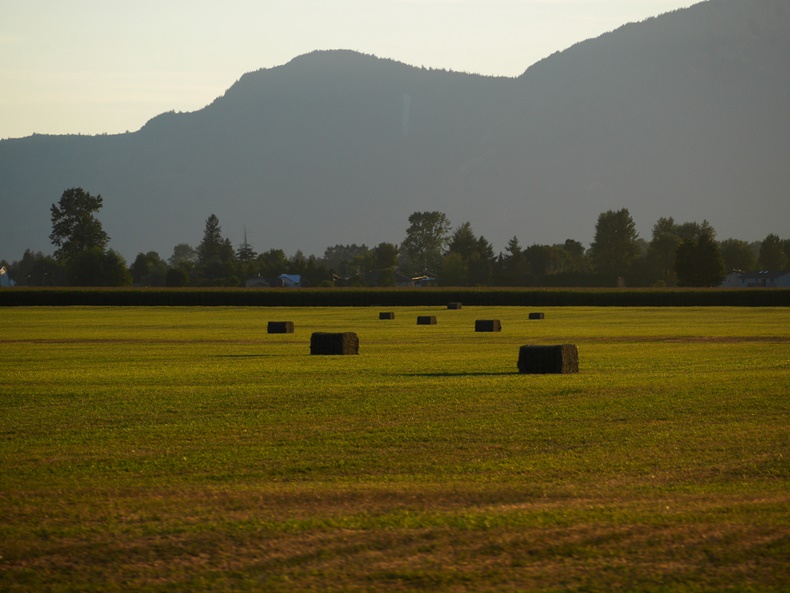
We begin in the Fraser Valley, a fertile delta plain where my roots began. My siblings and parents, although they moved away for many years, are all back in the Valley. Steep mountains shelter the valley, and it is to those mountains that we steer. 


We pass Mount Cheam, seen here from the east (and in the evening). Each time we pass it, I marvel that I once stood on the very top - I'd like to do that hike again some day.


Very soon we are in the mountains, taking the #5 Highway up over the Coquihalla Pass. These peaks are part of the Coast Mountain Range. Beautiful glaciers can still be seen, shining in the summer light. 


There's plenty of traffic on the highway: big trucks, tourists with their 5th-wheel trailers, motor homes, camper vans, and regular family cars. Some of them really slow down on the long, steep climbs. We climb from sea level to 1244 metres (4081 feet) in a little over an hour. 


The Coquihalla Highway is relatively new - just 30 years old. For part of the route, it follows old cattle trails and later oil and gas pipelines, installed in the 1950s. My father worked on those pipelines. The scenery is stunning as the road weaves through the mountains, along and across the Coquihalla and then the Coldwater Rivers.


After a couple of hours we come to the Interior Plateau. This is arid country, where cattle ranches flourish and thousands of lakes lie cool and blue in the landscape. 


Down into the small town of Merritt, where country music flourishes, and up again before descending into the town of Kamloops, situated at the confluence of the North and South Thompson Rivers. I spent my childhood here and swam in that cold, fast river.

We like to stop in Kamloops at the Starbucks on the eastern edge of town. We walk around the shopping center parking lot (it's only 8 am so the stores are still closed), sipping a cup of tea and munching on a breakfast sandwich. It's good to stretch our legs.


Back into the car again and we wind our way into the Shushwap and Okanagan Highlands. Shushwap Lake is a mecca for holiday-ers. Ski boats and houseboats dot the lake. It's enormous and there's plenty of room for all. 


Now we face the Columbia Mountain Ranges, of which there are four - the Caribou, the Cascades, the Monashee, and Selkirk Mountains. When I drive these roads, I marvel at the tenacity of the explorers who found the passes through wave after wave of mountains to forge transportation routes that are still used today. We go over the Rogers Pass (1330 m) and the Kicking Horse Pass (1627 m). 


We stop in Golden for lunch - a picnic, so we can get out and walk around again. Here we've descended a little and are in the Rocky Mountain Trench separating the Columbia Mountains from the Rocky Mountains.


A few wild summer flowers are blooming, but most have gone to seed.


A curious squirrel crosses the path ahead of us several times before dashing down beside the river to hide in the rocks.


Cold, cold glacier-fed water, milky from the glacial sediment.


The railway was built long before the highway and is a unifying symbol across the country. 


On our way home, we stopped, not in Golden, but at the Kicking Horse River rest area. Three rafts passed by as we watched. I hope to go river rafting one day. Have you ever done it?

The road at the bottom right of the photo is the old highway. We walked along it for about a kilometre or two. The bridge above is the new highway, and if you look carefully, you'll see the scale indicated by the tiny bumps of vehicles going over it. Called the Park Bridge, it was completed in 2007 and rises 90 metres above the river. The bridge, and its long approaches, replace the most dangerous part of the old highway, which averaged 140 accidents per year. 


Up into the Rocky Mountains we climb. We're about halfway there now. We pass through snow sheds and see warning signs to not stop in certain sections for fear of avalanches (in the winter). We see gun emplacements where experts shoot down the threatened avalanches. It's a hot day and there's no snow nearby so we don't concern ourselves with that.


A yellow helicopter hovers over a construction sight high on the mountain. Tim took this photo while I drove. We later saw it loading up again on a landing near the highway, preparing to make another drop.


Now we come to the Rocky Mountains, home to Banff National Park - Canada's first national park. Next year is the centennial of the park's opening, and as a celebration, all national park fees will be waived. 


We see a bear and some deer along the road. As we drive out of the mountains, they become less treed and more rocky.


This is Castle Mountain, aptly named, don't you think?


A storm brewed above us, but except for a few splats, it passed us by. Or perhaps we passed it. 


Wildlife overpasses allow the animals living here to safely cross the highways, which are otherwise fenced for their protection.


Just a few more hours on the level prairies where the landscape stretches as far as the eye can see and the sky looks immense.

We arrive in time for a late supper with Tim's sister - we meet at a restaurant since she wasn't expecting us until later. It feels good to crawl into bed that night, although my mind still felt it was driving. 

And in less than a week, we'll do the reverse! 

Thank you for your thoughts and prayers for Tim's mother. She is doing very well and has moved from the hospital into a transition home. She will soon be returning to her own apartment complex. 


Blogtober 2: Paintings of Domestic Scenes

  Flowers in the Window by Carl Larsson I've long been an admirer of Carl Larsson's paintings of his home life. They are filled with...